
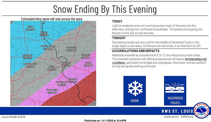
Rain will change to snow across Missouri from north to south through today, according to the National Weather Service.
Accumulations of 1-2 inches is possible in Mid-Missouri with locally higher amounts possible.
Accumulations and rapidly falling temperatures will result in slick travel.
The NWS issued this advisory for Mid-Missouri:
...WINTER WEATHER ADVISORY NOW IN EFFECT UNTIL 3 PM CST THIS AFTERNOON...
WHAT...Snow expected. Total snow accumulations up to 2 inches. Winds gusting as high as 35 mph.
WHERE... Portions of central and east central Missouri and south central and southwest Illinois.
IMPACTS...Plan on slippery road conditions. The hazardous conditions could impact the morning commute.
ADDITIONAL DETAILS...The rapid fall of temperatures into the 20s could result in a flash freeze of untreated roads and other surfaces.
PRECAUTIONARY/PREPAREDNESS ACTIONS... A Winter Weather Advisory for snow means that periods of accumulating snow will primarily cause travel difficulties. Roads may rapidly become slippery once the snow begins, so motorists should plan for a slower than normal trip. Be especially alert when approaching bridges, overpasses, and curves.
See also:
School and weather-related announcements for Monday, Nov. 11, 2019
MoDOT statewide traveler information map