
A Winter Weather Advisory is issued until noon Sunday for a variety of winter weather conditions across Mid-Missouri, such as snow, blowing snow, sleet or freezing drizzle and rain.
With temperatures just below freezing, Mid-Missouri police reported several wrecks in various locations due to vehicles running off slick roadways before road crews could treat icy spots.
The National Weather Service (NWS) advises it only takes a small amount of wintry precipitation to make roads, bridges, sidewalks and parking lots icy and dangerous. It is often difficult to tell when ice begins to form, so motorists should use extreme caution in order not to be caught off guard.
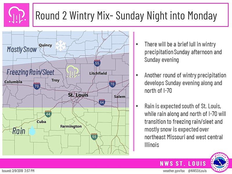
After a break in the precipitation Sunday afternoon, the NWS predicts a second round of wintry weather will affect the region Sunday night into Monday with freezing rain, sleet and snow. This could impact the Monday morning commute as residents head back to work. Light snow, sleet are ice accumulations are possible.
ADDITIONAL RESOURCES:
MoDOT statewide traveler information map